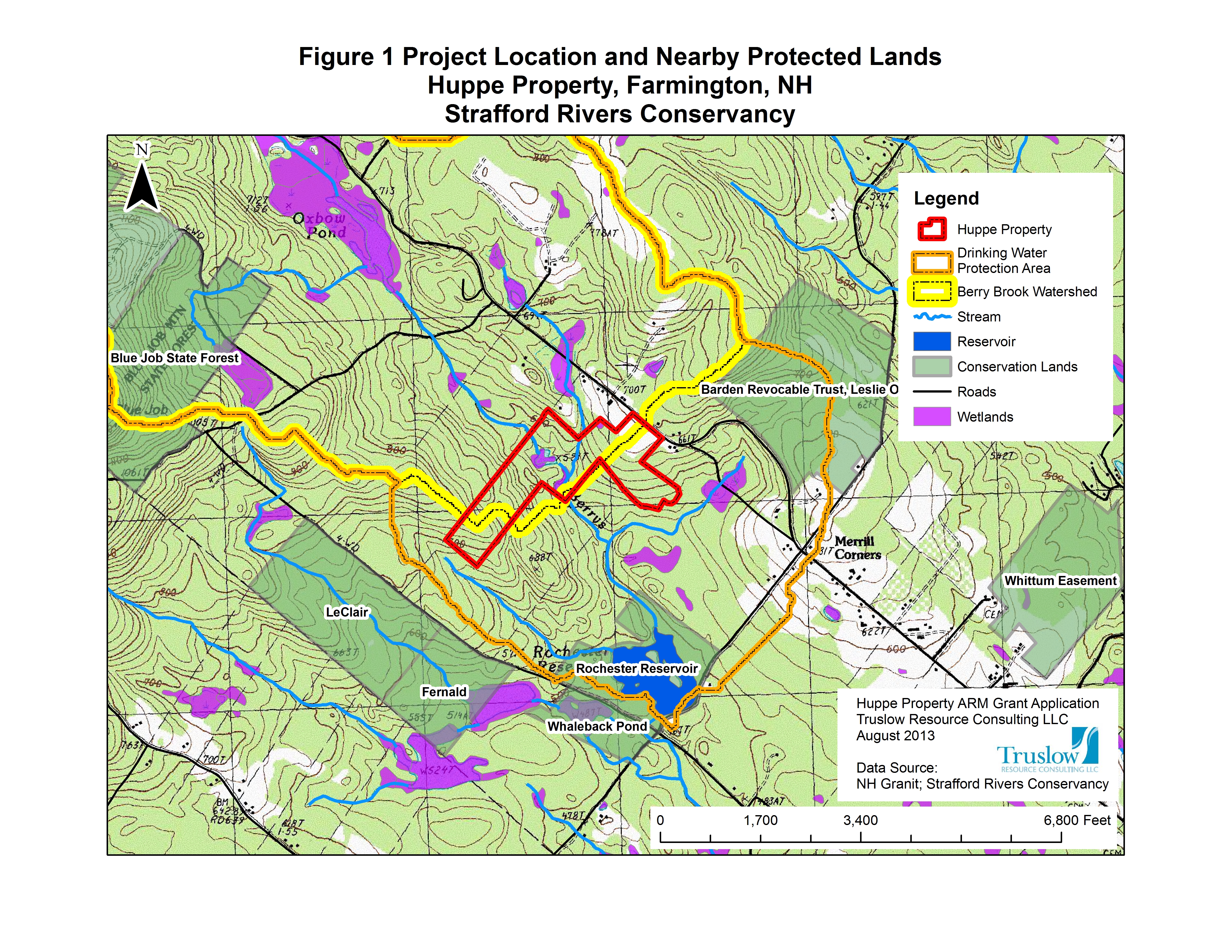
 Truslow Resource Consulting LLC offers a wide array of geographic information system services (GIS) to aid with planning, management, and reporting needs. Our services have assisted clients in dam removal feasibility studies, wetland functional value assessments (NH method), conservation land grant applications, environmental contamination analyses, floodplain analysis, groundwater investigations, resource planning studies, and in many other capacities. Final map products are of professional design quality and can be used in written reports, power point presentations, on websites, or as standalone large format maps.
Applications include:
- Natural resource and habitat mapping
- Watershed mapping
- Vegetation and land cover mapping
- Land use mapping
- Bedrock and surficial geology mapping
- Historical aerial photography land use and geomorphic analysis
- Environmental Contamination Site Mapping
- FEMA mapping presentation
- Infrastructure and utility mapping
- ARC Flow Analysis
- GIS Co-occurrence analysis
- GPS-based field data collection and mapping